
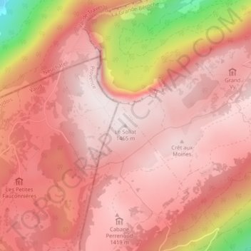
Le Soliat topographic map
Interactive map
Click on the map to display elevation.
About this map
Name: Le Soliat topographic map, elevation, terrain.
Average elevation: 1,312 m
Minimum elevation: 863 m
Maximum elevation: 1,459 m
Other topographic maps
Click on a map to view its topography, its elevation and its terrain.
Gorgier
Suisse > Neuchâtel > La Grande-Béroche
Gorgier, La Grande-Béroche, Neuchâtel, 2023, Suisse
Average elevation: 743 m
Vaumarcus
Suisse > Neuchâtel > La Grande-Béroche
Vaumarcus, La Grande-Béroche, Neuchâtel, 2028, Suisse
Average elevation: 521 m
Bevaix
Suisse > Neuchâtel > La Grande-Béroche > Bevaix
Bevaix, La Grande-Béroche, Neuchâtel, 2022, Suisse
Average elevation: 600 m