
West Bletchley topographic map
Interactive map
Click on the map to display elevation.
About this map
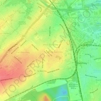
Name: West Bletchley topographic map, elevation, terrain.
Average elevation: 89 m
Minimum elevation: 57 m
Maximum elevation: 119 m
Other topographic maps
Click on a map to view its topography, its elevation and its terrain.
Far Bletchley
United Kingdom > England > Far Bletchley
Far Bletchley, Milton Keynes, South East, England, MK3 5JB, United Kingdom
Average elevation: 92 m