
Aua / King Billy Island topographic map
Interactive map
Click on the map to display elevation.
About this map
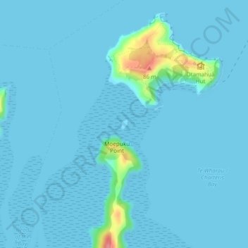
Name: Aua / King Billy Island topographic map, elevation, terrain.
Average elevation: 6 m
Minimum elevation: 0 m
Maximum elevation: 92 m
Other topographic maps
Click on a map to view its topography, its elevation and its terrain.
Lyttelton
Neuseeland > Canterbury > Christchurch City > Banks Peninsula Community
Lyttelton, Banks Peninsula Community, Christchurch City, Canterbury, 8082, Neuseeland
Average elevation: 99 m