
Pongo topographic map
Interactive map
Click on the map to display elevation.
About this map
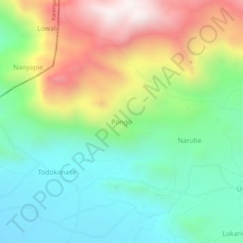
Name: Pongo topographic map, elevation, terrain.
Location: Pongo, Kaabong, Northern Region, Uganda (3.67044 33.99411 3.71044 34.03411)
Average elevation: 1,813 m
Minimum elevation: 1,451 m
Maximum elevation: 2,455 m
Other topographic maps
Click on a map to view its topography, its elevation and its terrain.