
Dundo topographic map
Interactive map
Click on the map to display elevation.
About this map
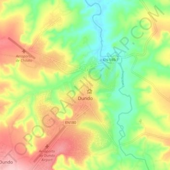
Name: Dundo topographic map, elevation, terrain.
Location: Dundo, Lunda Norte Province, Angola (-7.42109 20.79380 -7.34109 20.87380)
Average elevation: 701 m
Minimum elevation: 617 m
Maximum elevation: 799 m