
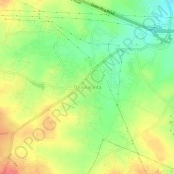
Thumukunta topographic map
Interactive map
Click on the map to display elevation.
About this map
Name: Thumukunta topographic map, elevation, terrain.
Average elevation: 585 m
Minimum elevation: 556 m
Maximum elevation: 613 m
Other topographic maps
Click on a map to view its topography, its elevation and its terrain.
Mazidpur
India > Telangana > Shamirpet mandal
Mazidpur, Shamirpet mandal, Medchal–Malkajgiri District, Telangana, 500078, India
Average elevation: 572 m
Shamirpet
India > Telangana > Shamirpet mandal
Shamirpet, Shamirpet mandal, Medchal–Malkajgiri, Telangana, 500078, India
Average elevation: 563 m
Shamirpet Lake
India > Telangana > Shamirpet mandal > Mazidpur
Shamirpet Lake, Mazidpur, Shamirpet mandal, Medchal–Malkajgiri, Telangana, India
Average elevation: 562 m