
Schwalbach topographic map
Interactive map
Click on the map to display elevation.
About this map
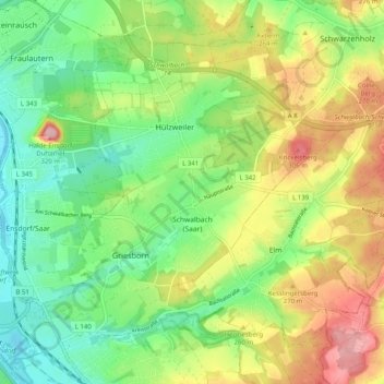
Name: Schwalbach topographic map, elevation, terrain.
Location: Schwalbach, Landkreis Saarlouis, Saarland, 66773, Germany (49.28203 6.78262 49.33401 6.88284)
Average elevation: 236 m
Minimum elevation: 175 m
Maximum elevation: 328 m
Other topographic maps
Click on a map to view its topography, its elevation and its terrain.