
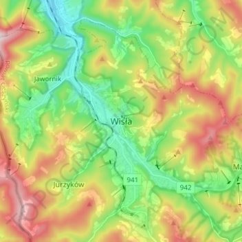
Weichsel topographic map
Interactive map
Click on the map to display elevation.
About this map
Name: Weichsel topographic map, elevation, terrain.
Average elevation: 607 m
Minimum elevation: 379 m
Maximum elevation: 946 m
Das Zentrum des Ortes liegt auf einer Höhe von 430 m und die umliegenden Täler auf Höhen von 300–600 m. Das Gemeindegebiet reicht bis auf 1220 m (im Gipfel der Barania Góra) hinauf.