
Bashkia Kurbin topographic map
Interactive map
Click on the map to display elevation.
About this map
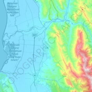
Name: Bashkia Kurbin topographic map, elevation, terrain.
Location: Bashkia Kurbin, Lezhë County, Northern Albania, Albania (41.55359 19.55676 41.72480 19.85724)
Average elevation: 234 m
Minimum elevation: -7 m
Maximum elevation: 1,518 m
Other topographic maps
Click on a map to view its topography, its elevation and its terrain.
Zejmen
Albania > Northern Albania > Lezhë County > Lezhë Municipality > Zejmen
Average elevation: 107 m