
Red Wood topographic map
Interactive map
Click on the map to display elevation.
About this map
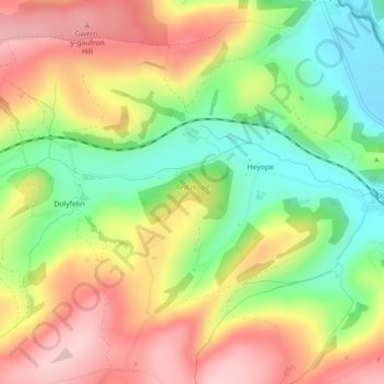
Name: Red Wood topographic map, elevation, terrain.
Location: Red Wood, Beguildy, Lloyney, Powys, Wales, United Kingdom (52.35921 -3.13076 52.36384 -3.11973)
Average elevation: 296 m
Minimum elevation: 192 m
Maximum elevation: 401 m