
Esch topographic map
Interactive map
Click on the map to display elevation.
About this map
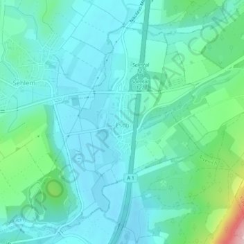
Name: Esch topographic map, elevation, terrain.
Average elevation: 174 m
Minimum elevation: 138 m
Maximum elevation: 329 m
Other topographic maps
Click on a map to view its topography, its elevation and its terrain.
Kautenbach
Deutschland > Rheinland-Pfalz > Landkreis Bernkastel-Wittlich > Traben-Trarbach
Kautenbach, Traben-Trarbach, Landkreis Bernkastel-Wittlich, Rheinland-Pfalz, 56841, Deutschland
Average elevation: 345 m