
Tegualda topographic map
Interactive map
Click on the map to display elevation.
About this map
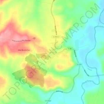
Name: Tegualda topographic map, elevation, terrain.
Average elevation: 134 m
Minimum elevation: 83 m
Maximum elevation: 203 m
Other topographic maps
Click on a map to view its topography, its elevation and its terrain.
Río Capitanes
Chile > Región de Los Lagos > Provincia de Llanquihue > Fresia
Río Capitanes, Fresia, Provincia de Llanquihue, Región de Los Lagos, Chile
Average elevation: 403 m