
Kuźnica Wąsowska topographic map
Interactive map
Click on the map to display elevation.
About this map
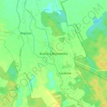
Name: Kuźnica Wąsowska topographic map, elevation, terrain.
Average elevation: 235 m
Minimum elevation: 224 m
Maximum elevation: 248 m
Other topographic maps
Click on a map to view its topography, its elevation and its terrain.
Koniecpol
Poland > Silesian Voivodeship > Częstochowa County
Koniecpol, gmina Koniecpol, Częstochowa County, Silesian Voivodeship, 42-230, Poland
Average elevation: 236 m