
Thank you for supporting this site ❤️
Make a donation
Make a donation
Gear up for your next adventure:
As an Amazon Associate, this site earns from qualifying purchases at no extra cost to you.
Atazar topographic map
Click on the map to display elevation.
Thank you for supporting this site ❤️
Make a donation
Make a donation
Gear up for your next adventure:
As an Amazon Associate, this site earns from qualifying purchases at no extra cost to you.
About this map
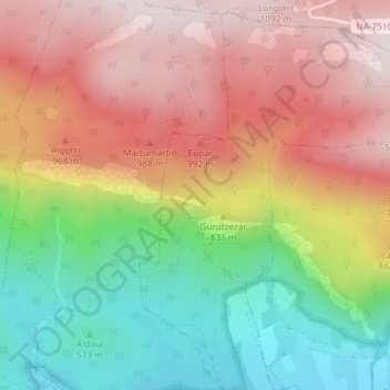
Name: Atazar topographic map, elevation, terrain.
Location: Atazar, Arruazu, Sakana, Navarra, 31839, España (42.93411 -2.02263 42.95411 -2.00263)
Average elevation: 796 m
Minimum elevation: 475 m
Maximum elevation: 1,092 m
Thank you for supporting this site ❤️
Make a donation
Make a donation
Gear up for your next adventure:
As an Amazon Associate, this site earns from qualifying purchases at no extra cost to you.