
Kayonza topographic map
Interactive map
Click on the map to display elevation.
About this map
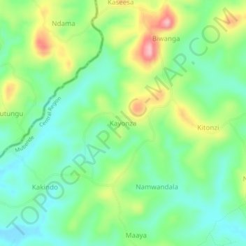
Name: Kayonza topographic map, elevation, terrain.
Location: Kayonza, Mubende, Central Region, Uganda (0.42369 31.12448 0.46369 31.16448)
Average elevation: 1,342 m
Minimum elevation: 1,282 m
Maximum elevation: 1,454 m
Other topographic maps
Click on a map to view its topography, its elevation and its terrain.