Ajloun Forest Reserve topographic map
Interactive map
Click on the map to display elevation.
About this map
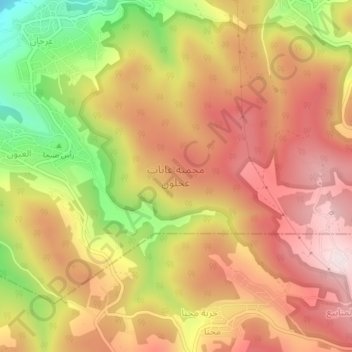
Name: Ajloun Forest Reserve topographic map, elevation, terrain.
Average elevation: 837 m
Minimum elevation: 507 m
Maximum elevation: 1,064 m

Click on the map to display elevation.
Name: Ajloun Forest Reserve topographic map, elevation, terrain.
Average elevation: 837 m
Minimum elevation: 507 m
Maximum elevation: 1,064 m