
Shamal Madinat as Saadah topographic map
Interactive map
Click on the map to display elevation.
About this map
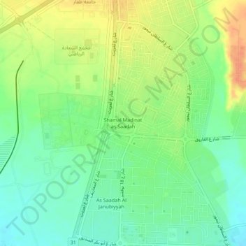
Name: Shamal Madinat as Saadah topographic map, elevation, terrain.
Location: Shamal Madinat as Saadah, Salalah, Dhofar, Oman (17.05000 54.12962 17.09000 54.16962)
Average elevation: 32 m
Minimum elevation: 13 m
Maximum elevation: 56 m
Other topographic maps
Click on a map to view its topography, its elevation and its terrain.