
Hasenacker topographic map
Interactive map
Click on the map to display elevation.
About this map
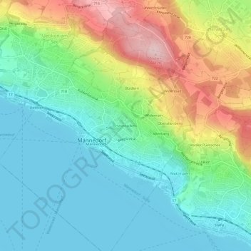
Name: Hasenacker topographic map, elevation, terrain.
Location: Hasenacker, Männedorf, Bezirk Meilen, Zürich, 8708, Schweiz (47.23547 8.67978 47.27547 8.71978)
Average elevation: 484 m
Minimum elevation: 402 m
Maximum elevation: 661 m