
Ngonye Falls topographic map
Interactive map
Click on the map to display elevation.
About this map
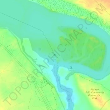
Name: Ngonye Falls topographic map, elevation, terrain.
Location: Ngonye Falls, Sioma District, Western Province, Zambia (-16.65008 23.57149 -16.64998 23.57159)
Average elevation: 985 m
Minimum elevation: 970 m
Maximum elevation: 1,004 m
Other topographic maps
Click on a map to view its topography, its elevation and its terrain.
Ngonye Falls
Ngonye Falls, Sioma District, Western Province, Zambia
Average elevation: 985 m
Lukulu
Zambia > Western Province > Lukulu
Lukulu, Lukulu District, Western Province, Zambia
Average elevation: 1,041 m
Kalabo
Kalabo, Kalabo District, Western Province, Zambia
Average elevation: 1,027 m
Kaoma
Kaoma, Kaoma District, Western Province, Zambia
Average elevation: 1,160 m
Mongu
Mongu, Mongu District, Western Province, Zambia
Average elevation: 1,037 m