
Boogertown topographic map
Interactive map
Click on the map to display elevation.
About this map
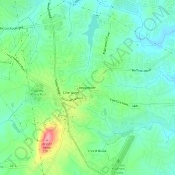
Name: Boogertown topographic map, elevation, terrain.
Average elevation: 236 m
Minimum elevation: 203 m
Maximum elevation: 316 m
Other topographic maps
Click on a map to view its topography, its elevation and its terrain.
Crowders Mountain
United States > North Carolina > Gaston County > Gastonia
Crowders Mountain, Gastonia, Gaston County, North Carolina, United States
Average elevation: 284 m
Gastonia
United States > North Carolina > Gaston County > Gastonia > Gastonia
Gastonia, Gaston County, North Carolina, 28054, United States
Average elevation: 234 m