
Brookville topographic map
Interactive map
Click on the map to display elevation.
About this map
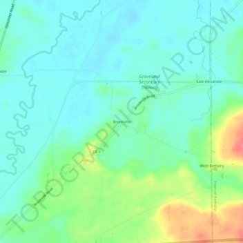
Name: Brookville topographic map, elevation, terrain.
Average elevation: 290 m
Minimum elevation: 272 m
Maximum elevation: 337 m
Other topographic maps
Click on a map to view its topography, its elevation and its terrain.
Ray
United States > New York > Genesee County > Town of Alexander
Ray, Town of Alexander, Genesee County, New York, 14005, United States
Average elevation: 295 m
North Alexander
United States > New York > Genesee County > Town of Alexander
North Alexander, Town of Alexander, Genesee County, New York, 14005, United States
Average elevation: 288 m
East Alexander
United States > New York > Genesee County > Town of Alexander
East Alexander, Town of Alexander, Genesee County, New York, United States
Average elevation: 294 m