
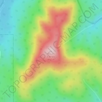
Mount Everett topographic map
Interactive map
Click on the map to display elevation.
About this map
Name: Mount Everett topographic map, elevation, terrain.
Location: Mount Everett, Burnie, Tasmania, 7320, Australia (-41.36039 145.86525 -41.36029 145.86535)
Average elevation: 678 m
Minimum elevation: 548 m
Maximum elevation: 871 m
Other topographic maps
Click on a map to view its topography, its elevation and its terrain.
Chasm Creek
Australia > Tasmania > Burnie > Chasm Creek
Chasm Creek, Burnie, City of Burnie, Tasmania, Australia
Average elevation: 49 m