
Lac Michèle topographic map
Interactive map
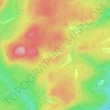
Click on the map to display elevation.
About this map
Name: Lac Michèle topographic map, elevation, terrain.
Average elevation: 305 m
Minimum elevation: 211 m
Maximum elevation: 382 m
Other topographic maps
Click on a map to view its topography, its elevation and its terrain.
Lac Cascapédia
Canada > Québec > Mont-Albert
Lac Cascapédia, 11, Mont-Albert, La Haute-Gaspésie, Gaspésie–Îles-de-la-Madeleine, Québec, Canada
Average elevation: 621 m
Mont Jacques-Cartier
Canada > Québec > Mont-Albert
Mont Jacques-Cartier, Mont-Albert, La Haute-Gaspésie, Gaspésie–Îles-de-la-Madeleine, Québec, Canada
Average elevation: 1,137 m