
Amirsay topographic map
Interactive map
Click on the map to display elevation.
Amirsay
The Amirsoy resort covers an area of 900 hectares on the northern slope of Maygashkan Mountain, part of the Chatkal Range in the Western Tian Shan. The elevation of the ski slopes is between 1,630m and 2,275m.
About this map
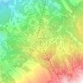
Name: Amirsay topographic map, elevation, terrain.
Location: Amirsay, Bostanlik district, Tashkent Region, Uzbekistan (41.48076 69.93445 41.49212 69.94789)
Average elevation: 1,626 m
Minimum elevation: 1,213 m
Maximum elevation: 2,153 m
Other topographic maps
Click on a map to view its topography, its elevation and its terrain.