
Parcul Circului topographic map
Interactive map
Click on the map to display elevation.
About this map
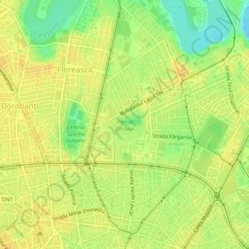
Name: Parcul Circului topographic map, elevation, terrain.
Location: Parcul Circului, Tei, Sector 2, Bucharest, Romania (44.45493 26.10714 44.45948 26.11390)
Average elevation: 85 m
Minimum elevation: 67 m
Maximum elevation: 93 m
Other topographic maps
Click on a map to view its topography, its elevation and its terrain.