
Herndon topographic map
Interactive map
Click on the map to display elevation.
About this map
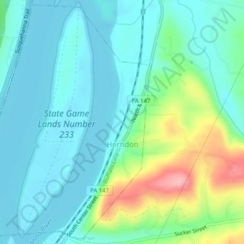
Name: Herndon topographic map, elevation, terrain.
Location: Herndon, Northumberland County, Pennsylvania, United States (40.69890 -76.86922 40.72496 -76.83823)
Average elevation: 156 m
Minimum elevation: 121 m
Maximum elevation: 272 m