
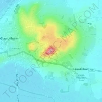
Glastonbury Tor topographic map
Interactive map
Click on the map to display elevation.
About this map
Name: Glastonbury Tor topographic map, elevation, terrain.
Average elevation: 33 m
Minimum elevation: 4 m
Maximum elevation: 148 m
Somerset trails, hiking, mountain biking, running and outdoor activities
Other topographic maps
Click on a map to view its topography, its elevation and its terrain.
Glastonbury Tor
United Kingdom > England > Somerset > Glastonbury
The Tor is in the middle of the Summerland Meadows, part of the Somerset Levels, rising to an elevation of 518 feet (158 m). The plain is reclaimed fen above which the Tor is clearly visible for miles around. It has been described as an island, but actually sits at the western end of a peninsula washed on…
Average elevation: 33 m