Geolocate

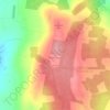
Mucklone topographic map

Click on the map to display elevation.

About this map

Name: Mucklone topographic map, elevation, terrain.

Location: Mucklone, Cappalough ED, The Municipal District of Borris-in-Ossory — Mountmellick, County Laois, Leinster, Ireland (53.16460 -7.40854 53.17933 -7.38390)

Average elevation: 80 m

Minimum elevation: 74 m

Maximum elevation: 91 m

Other topographic maps

Click on a map to view its topography, its elevation and its terrain.
Timahoe

Ireland > County Laois

Average elevation: 146 m

Newtown

Ireland > County Laois

Average elevation: 187 m

Timahoe Round Tower

Ireland > County Laois

Average elevation: 137 m

Cullenagh Mountain

Ireland > County Laois

Average elevation: 226 m

Glasha

Ireland > County Laois

Average elevation: 58 m

Sheffield Cross

Ireland > County Laois

Average elevation: 119 m

Rosenallis

Ireland > County Laois

Average elevation: 114 m

Knockardagur

Ireland > County Laois

Average elevation: 248 m

Gear up for your next adventure:

🥾Walking Shoes - Lightweight walking shoes for countryside and coastal paths
🔋Lithium AA Batteries - Long-lasting power that performs well in cold mountain weather
🧥Waterproof Hiking Jackets - Rain protection for walking in all weather conditions
🗺️Topographic Maps - Detailed maps showing elevation and terrain features
👖Packable Overtrousers - Quick-deploy rain protection for legs in sudden storms

As an Amazon Associate, this site earns from qualifying purchases at no extra cost to you.