
Wietzendorf topographic map
Interactive map
Click on the map to display elevation.
About this map
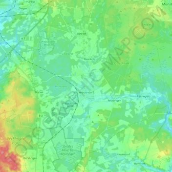
Name: Wietzendorf topographic map, elevation, terrain.
Location: Wietzendorf, Heidekreis, Lower Saxony, 29649, Germany (52.86699 9.85593 52.97983 10.08022)
Average elevation: 78 m
Minimum elevation: 56 m
Maximum elevation: 143 m
Other topographic maps
Click on a map to view its topography, its elevation and its terrain.