Geolocate

Pirpainti topographic map

Click on the map to display elevation.

About this map

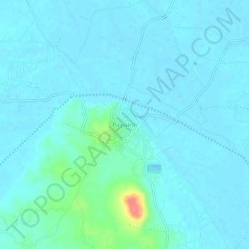
Name: Pirpainti topographic map, elevation, terrain.

Location: Pirpainti, Bhagalpur, Bihar, 813209, India (25.30322 87.40759 25.34322 87.44759)

Average elevation: 36 m

Minimum elevation: 28 m

Maximum elevation: 98 m

Gear up for your next adventure:

🗺️Topographic Maps - Detailed maps showing elevation and terrain features
🎒Hiking Backpacks - Comfortable backpacks for day hikes and multi-day treks
🧺Mesh Stuff Sacks - Breathable storage for wet gear or camp organization
🧊Insulated Flasks - Keeps drinks hot or cold during hikes
🖼️Topographic Map Art - Decorative 3D-effect posters of famous UK peaks and regions

As an Amazon Associate, this site earns from qualifying purchases at no extra cost to you.