
Saillancourt topographic map
Interactive map
Click on the map to display elevation.
About this map
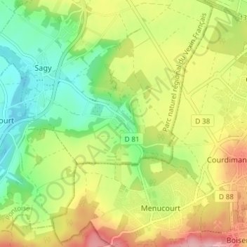
Name: Saillancourt topographic map, elevation, terrain.
Average elevation: 105 m
Minimum elevation: 40 m
Maximum elevation: 189 m
Other topographic maps
Click on a map to view its topography, its elevation and its terrain.
Le Grand Mesnil
France > Île-de-France > Val-d'Oise > Sagy
Le Grand Mesnil, Sagy, Pontoise, Val-d'Oise, Île-de-France, France métropolitaine, 95450, France
Average elevation: 93 m