
Wengwald topographic map
Interactive map
Click on the map to display elevation.
About this map
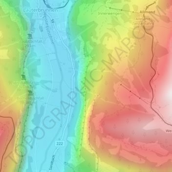
Name: Wengwald topographic map, elevation, terrain.
Average elevation: 1,304 m
Minimum elevation: 782 m
Maximum elevation: 1,969 m
Other topographic maps
Click on a map to view its topography, its elevation and its terrain.
Schilthorn
Zwitserland > Bern/Berne > Lauterbrunnen
Schilthorn, Lauterbrunnen, Verwaltungskreis Interlaken-Oberhasli, Verwaltungsregion Oberland, Bern/Berne, Zwitserland
Average elevation: 2,457 m