
Province of Lamas topographic map
Interactive map
Click on the map to display elevation.
About this map
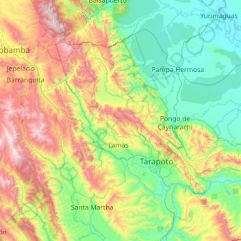
Name: Province of Lamas topographic map, elevation, terrain.
Location: Province of Lamas, San Martín, 22170, Peru (-6.69462 -76.88417 -5.95066 -75.89996)
Average elevation: 717 m
Minimum elevation: 124 m
Maximum elevation: 2,281 m