
Cercle de Kati topographic map
Interactive map
Click on the map to display elevation.
About this map
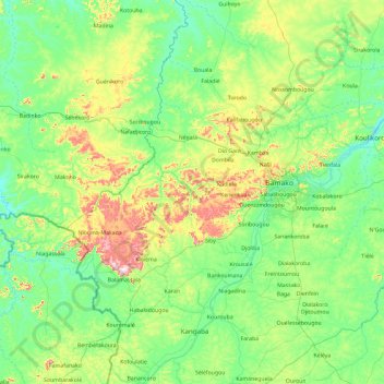
Name: Cercle de Kati topographic map, elevation, terrain.
Location: Cercle de Kati, Koulikoro, 76764317, Malí (11.68600 -9.04414 13.51800 -7.42400)
Average elevation: 382 m
Minimum elevation: 289 m
Maximum elevation: 796 m
Other topographic maps
Click on a map to view its topography, its elevation and its terrain.