
Anse du Port au Persil topographic map
Interactive map
Click on the map to display elevation.
About this map
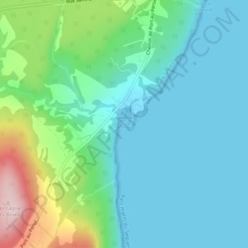
Name: Anse du Port au Persil topographic map, elevation, terrain.
Average elevation: 72 m
Minimum elevation: -1 m
Maximum elevation: 312 m
Other topographic maps
Click on a map to view its topography, its elevation and its terrain.
Rivière-Noire
Canada > Quebec > Saint-Siméon > Rivière-Noire
Rivière-Noire, Saint-Siméon, Charlevoix-Est, Capitale-Nationale, Quebec, G0T 1X0, Canada
Average elevation: 68 m