
Distrito Municipal de KaMavota topographic map
Interactive map
Click on the map to display elevation.
About this map
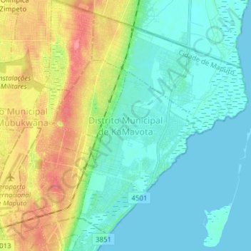
Name: Distrito Municipal de KaMavota topographic map, elevation, terrain.
Location: Distrito Municipal de KaMavota, Maputo, Zona Sul, Mozambique (-25.93345 32.57638 -25.83324 32.70106)
Average elevation: 20 m
Minimum elevation: -2 m
Maximum elevation: 68 m
Other topographic maps
Click on a map to view its topography, its elevation and its terrain.