
Sainte-Marie-du-Mont topographic map
Interactive map
Click on the map to display elevation.
About this map
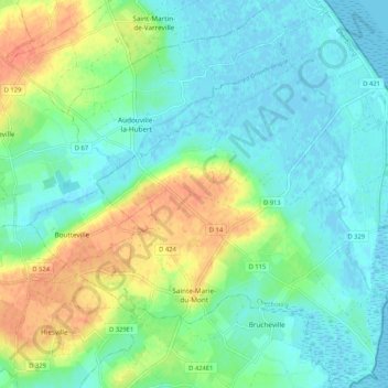
Name: Sainte-Marie-du-Mont topographic map, elevation, terrain.
Average elevation: 13 m
Minimum elevation: -2 m
Maximum elevation: 41 m
Other topographic maps
Click on a map to view its topography, its elevation and its terrain.
La Douveterie
France > Normandy > Manche > La Lucerne-d'Outremer
La Douveterie, La Lucerne-d'Outremer, Avranches, Manche, Normandy, Metropolitan France, 50320, France
Average elevation: 107 m
Le Domaine
France > Normandy > Manche > Le Teilleul
Le Domaine, Le Teilleul, Avranches, Manche, Normandy, Metropolitan France, 50640, France
Average elevation: 167 m