
Río Santiago topographic map
Interactive map
Click on the map to display elevation.
About this map
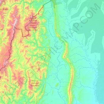
Name: Río Santiago topographic map, elevation, terrain.
Location: Río Santiago, Amazonas, Perú (-4.43790 -78.21966 -2.99609 -77.63982)
Average elevation: 590 m
Minimum elevation: 133 m
Maximum elevation: 2,914 m
Other topographic maps
Click on a map to view its topography, its elevation and its terrain.
Santa María de Nieva
Santa María de Nieva, Nieva, Condorcanqui, Amazonas, Perú
Average elevation: 209 m
Cocachimba
Cocachimba, Valera, Bongará, Amazonas, Perú
Average elevation: 1,970 m
Bagua Grande
Perú > Amazonas > Bagua Grande
Bagua Grande, Provincia de Utcubamba, Amazonas, Perú
Average elevation: 1,250 m
Provincia de Condorcanqui
Provincia de Condorcanqui, El Cenepa, Condorcanqui, Amazonas, Perú
Average elevation: 889 m