Geolocate

Banham topographic map

Click on the map to display elevation.

About this map

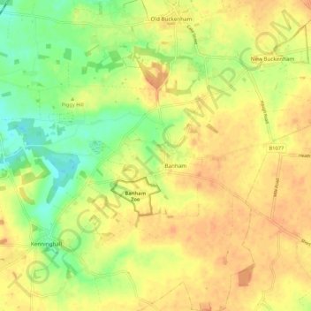
Name: Banham topographic map, elevation, terrain.

Location: Banham, Breckland District, Norfolk, England, United Kingdom (52.43305 0.99072 52.47040 1.09679)

Average elevation: 46 m

Minimum elevation: 25 m

Maximum elevation: 59 m

Norfolk trails, hiking, mountain biking, running and outdoor activities

Gear up for your next adventure:

📢Survival Whistles - Essential safety gear for signaling for help in mountain fog
🧦Merino Wool Hiking Socks - Moisture-wicking socks to prevent blisters during long mountain walks
🥾Women's Waterproof Hiking Boots - High-performance trekking boots designed for all-weather comfort
🕶️Glacier Goggles - Maximum protection for high-altitude snow topography
🧺Microfibre Travel Towels - Fast-drying and compact towels for wild swimming and camping

As an Amazon Associate, this site earns from qualifying purchases at no extra cost to you.