
ABU Dam topographic map
Interactive map
Click on the map to display elevation.
About this map
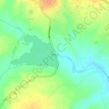
Name: ABU Dam topographic map, elevation, terrain.
Location: ABU Dam, Jama A, Sabon Gari, Kaduna State, Nigeria (11.13080 7.65618 11.13799 7.65835)
Average elevation: 652 m
Minimum elevation: 633 m
Maximum elevation: 674 m