
Torslanda topographic map
Interactive map
Click on the map to display elevation.
About this map
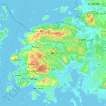
Name: Torslanda topographic map, elevation, terrain.
Average elevation: 10 m
Minimum elevation: -4 m
Maximum elevation: 63 m
Other topographic maps
Click on a map to view its topography, its elevation and its terrain.
Strömstads kommun
Suecia > Provincia de Västra Götaland
Strömstads kommun, Provincia de Västra Götaland, Suecia
Average elevation: 60 m
Ale kommun
Suecia > Provincia de Västra Götaland
Ale kommun, Provincia de Västra Götaland, Suecia
Average elevation: 87 m