Geolocate

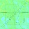
Friendship topographic map

Click on the map to display elevation.

About this map

Name: Friendship topographic map, elevation, terrain.

Location: Friendship, Livingston Parish, Louisiana, United States (30.56269 -90.89093 30.60269 -90.85093)

Average elevation: 22 m

Minimum elevation: 14 m

Maximum elevation: 30 m

Other topographic maps

Click on a map to view its topography, its elevation and its terrain.

Walker

United States > Louisiana > Livingston Parish

Average elevation: 12 m

Albany

United States > Louisiana > Livingston Parish

Average elevation: 12 m

Albany

United States > Louisiana > Livingston Parish

Average elevation: 12 m

Gear up for your next adventure:

📚UK Hiking Guidebooks - Detailed route descriptions for the Lake District, Peaks, and Highlands
🛰️Satellite Messengers - Emergency communication devices for areas without mobile signal
🚲Bikepacking Frame Bags - Storage for tools and navigation gear on long off-road rides
🦟Anti-Midge & Tick Repellent - Vital for hiking in the Scottish Highlands during summer
👕Merino Base Layers - Natural temperature regulation for cold weather hiking and camping

As an Amazon Associate, this site earns from qualifying purchases at no extra cost to you.