Geolocate

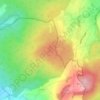
Stockhausen topographic map

Click on the map to display elevation.

About this map

Name: Stockhausen topographic map, elevation, terrain.

Location: Stockhausen, Herbstein, Vogelsbergkreis, Hesse, 36358, Germany (50.53200 9.37813 50.58122 9.49777)

Average elevation: 383 m

Minimum elevation: 254 m

Maximum elevation: 496 m

Other topographic maps

Click on a map to view its topography, its elevation and its terrain.

Schmitten

Germany > Hesse > Vogelsbergkreis > Sellnrod

Average elevation: 383 m

Dick

Germany > Hesse > Vogelsbergkreis

Average elevation: 378 m

Lauterbach

Germany > Hesse > Vogelsbergkreis

Average elevation: 361 m

Gear up for your next adventure:

🧭Professional Hiking Compasses - High-precision liquid-filled compasses for map reading and orientation
⌚Altimeter Watches - Watches measuring altitude for mountain activities
🗺️Topographic Maps - Detailed maps showing elevation and terrain features
🥄Titanium Camping Sporks - The ultimate lightweight utensil for trail meals
🌂Windproof Trekking Umbrellas - Surprising but effective rain protection on low-wind trails

As an Amazon Associate, this site earns from qualifying purchases at no extra cost to you.