Geolocate

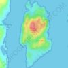
Luing topographic map

Click on the map to display elevation.

About this map

Name: Luing topographic map, elevation, terrain.

Location: Luing, Toberonochy, Argyll and Bute, Scotland, United Kingdom (56.18816 -5.66578 56.27083 -5.61762)

Average elevation: 13 m

Minimum elevation: -2 m

Maximum elevation: 260 m

Other topographic maps

Click on a map to view its topography, its elevation and its terrain.
Gear up for your next adventure:

👖Packable Overtrousers - Quick-deploy rain protection for legs in sudden storms
🥤Hiking Water Bottles - Reusable bottles for hydration on the trail
🥤Hydration Bladders - Hands-free hydration systems for backpacks
🧼Technical Clothing Wash - Special soap to clean and restore waterproof membranes
🧺Ultralight Dry Bags - Organize and waterproof your gear inside your rucksack

As an Amazon Associate, this site earns from qualifying purchases at no extra cost to you.