Geolocate

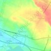
Bulukandang topographic map

Click on the map to display elevation.

About this map

Name: Bulukandang topographic map, elevation, terrain.

Location: Bulukandang, Pasuruan, East Java, 67161, Indonesia (-7.71152 112.66229 -7.67152 112.70229)

Average elevation: 323 m

Minimum elevation: 188 m

Maximum elevation: 660 m

Other topographic maps

Click on a map to view its topography, its elevation and its terrain.
Batas Desa Sumberanyar

Indonesia > East Java > Pasuruan

Average elevation: 39 m

Gear up for your next adventure:

🔋Rechargeable Batteries - Eco-friendly power for headlamps and older GPS units
🥤Hydration Bladders - Hands-free hydration systems for backpacks
📷Outdoor Action Cameras - Cameras designed for hiking and adventure
🛰️Handheld GPS Devices - Reliable GPS units for hiking and outdoor navigation
🔦Outdoor Torches - Reliable torches for night navigation

As an Amazon Associate, this site earns from qualifying purchases at no extra cost to you.