Geolocate

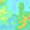
Haobi topographic map

Click on the map to display elevation.

About this map

Name: Haobi topographic map, elevation, terrain.

Location: Haobi, Churachandpur Subdivision, Churachandpur district, Manipur, India (24.18440 93.78216 24.18450 93.78226)

Average elevation: 1,246 m

Minimum elevation: 863 m

Maximum elevation: 1,552 m

Other topographic maps

Click on a map to view its topography, its elevation and its terrain.
Khuga Dam

India > Manipur > Churachandpur subdivision > Saipum

Average elevation: 849 m

Gear up for your next adventure:

👖Packable Overtrousers - Quick-deploy rain protection for legs in sudden storms
🎿Telescopic Trekking Poles - Reduces knee strain on steep topographic descents
🌄Compact Monoculars - Lightweight optics for hiking
👟Heavy Duty Boot Laces - Always carry a spare for your hiking footwear
🛌Sleeping Bags - Warm and packable sleeping bags for outdoor nights

As an Amazon Associate, this site earns from qualifying purchases at no extra cost to you.