Geolocate

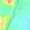
Dallol topographic map

Click on the map to display elevation.

About this map

Name: Dallol topographic map, elevation, terrain.

Location: Dallol, Zone 2, Afar Region, Ethiopia (14.24242 40.29964 14.24252 40.29974)

Average elevation: -105 m

Minimum elevation: -124 m

Maximum elevation: -77 m

Other topographic maps

Click on a map to view its topography, its elevation and its terrain.
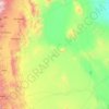
Danakil Depression

Ethiopia > Afar Region

Average elevation: 146 m

Zone 4

Ethiopia > Afar Region

Average elevation: 875 m

water way

Ethiopia > Afar Region

Average elevation: 789 m

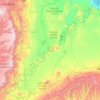
Danakil Depression

Ethiopia > Afar Region

Average elevation: -105 m

Mille

Ethiopia > Afar Region > Lower Miele

Average elevation: 496 m

Zone 3

Ethiopia > Afar Region

Average elevation: 1,230 m

Gear up for your next adventure:

📱Rugged Phone Cases - Heavy-duty protection for smartphones used as secondary GPS tools
🔥Emergency Fire Starters - Reliable ignition tools for survival situations in damp conditions
🦯Walking Poles - Supportive poles for long-distance walking
🧣Neck Gaiters - Protects against wind and sun on exposed ridges and peaks
👟Women's Trail Running Shoes - Agile footwear for fell running and technical trails

As an Amazon Associate, this site earns from qualifying purchases at no extra cost to you.