Geolocate

Argentona topographic map

Click on the map to display elevation.

About this map
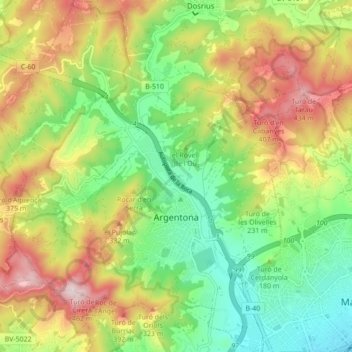
Name: Argentona topographic map, elevation, terrain.

Location: Argentona, Maresme, Barcelona, Catalonia, 08310, Spain (41.53048 2.35541 41.59531 2.42698)

Average elevation: 196 m

Minimum elevation: 3 m

Maximum elevation: 463 m

Other topographic maps

Click on a map to view its topography, its elevation and its terrain.

Palafolls

Spain > Catalonia > Maresme > Palafolls > Palafolls

Average elevation: 26 m

Gear up for your next adventure:

🥼Base Layers - Thermal base layers for temperature regulation
🥄Titanium Camping Sporks - The ultimate lightweight utensil for trail meals
🎒Hiking Daypacks - Compact backpacks ideal for short hikes and excursions
🛰️Outdoor GPS Navigation - Navigation devices for remote and off-grid areas
👖Convertible Hiking Trousers - Versatile zip-off pants for changing mountain weather conditions

As an Amazon Associate, this site earns from qualifying purchases at no extra cost to you.