
Thank you for supporting this site ❤️
Make a donation
Make a donation
Gear up for your next adventure:
As an Amazon Associate, this site earns from qualifying purchases at no extra cost to you.
Doganaccia topographic map
Click on the map to display elevation.
Thank you for supporting this site ❤️
Make a donation
Make a donation
Gear up for your next adventure:
As an Amazon Associate, this site earns from qualifying purchases at no extra cost to you.
About this map
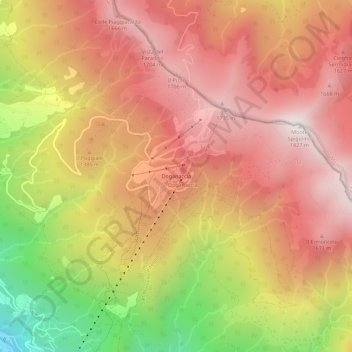
Name: Doganaccia topographic map, elevation, terrain.
Location: Doganaccia, Abetone Cutigliano, Pistoia, Tuscany, 51020, Italy (44.10198 10.75580 44.14198 10.79580)
Average elevation: 1,343 m
Minimum elevation: 588 m
Maximum elevation: 1,815 m
Thank you for supporting this site ❤️
Make a donation
Make a donation
Gear up for your next adventure:
As an Amazon Associate, this site earns from qualifying purchases at no extra cost to you.
Other topographic maps
Click on a map to view its topography, its elevation and its terrain.