Geolocate

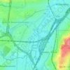
Anderlecht topographic map

Click on the map to display elevation.

About this map

Name: Anderlecht topographic map, elevation, terrain.

Location: Anderlecht, Brussels-Capital, 1070, Belgium (50.80706 4.24377 50.85032 4.34011)

Average elevation: 43 m

Minimum elevation: 16 m

Maximum elevation: 107 m

Other topographic maps

Click on a map to view its topography, its elevation and its terrain.
Aa

Belgium > Brussels-Capital > Anderlecht

Average elevation: 35 m

Aa

Belgium > Brussels-Capital > Anderlecht

Average elevation: 35 m

Gear up for your next adventure:

🪓Outdoor Multitools - Versatile tools for hiking and camping
🦟Anti-Midge & Tick Repellent - Vital for hiking in the Scottish Highlands during summer
🔦LED Camping Lanterns - Illumination for reading maps inside your tent at night
🧰Survival Kits - Emergency tools for remote environments
🗺️Ordnance Survey Maps - Official UK maps for walking and outdoor activities

As an Amazon Associate, this site earns from qualifying purchases at no extra cost to you.